Metsamor Nuclear Power Plant: The World’s Most Dangerous Plant

By Saahel Alimagham, SFSU 2021

The Metsamor Nuclear Power Plant is located in Metsamor, Armenia and is considered to be the world’s most dangerous power plant. This plant is one of the only remaining plants in the world that was built without containment, a critical safety feature. Metsamor was built upon some of the world’s most earthquake vulnerable zones, creating a constant threat to the safety of the surrounding cities and individuals. [1] It is considered to be so dangerous because in the event of a natural disaster, the lack of containment would allow harmful gasses and pollution to pour out directly into the environment. The European Union has urged Armenia to close down the site for years, and offered $289 million to finance shutting down the plant, which Armenia declined.

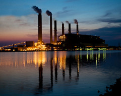
Steam rising from the Metsamor Nuclear Power Plant (GettyImages)

Armenia’s unstable history with power

Prior to the construction of the Metsamor power plant, Armenia faced massive barriers in finding a stable energy source. Due to conflict between Armenia and other regions, most neighboring countries have closed their trading borders with Armenia, cutting off routes for other energy sources such as oil and gas. [2] Thus, a nuclear energy source was the only option for Armenia, and the plant was built in 1976. Twelve years later in 1988, a massive earthquake hit Armenia, killing over 25,000 people and leaving half a million individuals without a home. Thankfully, the plant withstood the quake but officials were still weary. The plant was shut down in fears of it being damaged if another earthquake happened. When Metsamor was shut down, Armenia faced extreme energy poverty. Citizens were without power for most of the day, suffering in the cold winter months without any heat. Severe power shortages oftentimes left individuals without electricity for a week in the height of the winter. This went on for about six years, until the country decided to reopen the plant. [3]

Damages from the Earthquake in Armenia (C.J Langer)

Sacrificing a healthy life for energy

 A sacrifice zone is defined as a place that is written off for environmental destruction in the name of a higher purpose, such as the national interest. Metsamor, Armenia is precisely that. Living so close to such a massive radiator has direct impacts on the town. Cut up radiator bits and other pollution are prevalent around the city. Clean drinking water is not very accessible and there is heavy water pollution. Metsamor’s air quality is immensely poor and low in quality. Many of the residents are incredibly dissatisfied with the quality of life and find it draining and troubling to spend time in their city. [4] As stated before, the Metsamor plant was built without adequate containment. That being said, if there were to be a natural disaster that damages the plant, the dangerous toxins and chemicals would directly harm and affect Metsamor and its citizens. Before Metsamor was built, the town experienced constant power outages that would sometimes last weeks which devastated the city. The residents of Metsamor are forced to sacrifice having safe buildings, adequate air quality and water accessibility for power. [3] There is virtually no local pushback against the powerplant because it provides jobs to the locals and they are terrified of having to live through such an extreme power shortage once again. [5] The plant provides the country with 33% of its energy, so the majority of Armenian citizens are benefitting from it, while the residents of Metsamor are paying the harmful costs of the plant. They have to sacrifice one source of safety for another, and the residents have no choice but to accept the potentially harmful effects of the plant. 

Rich in energy, poor in life

The city of Metsamor is poor and run down, riddled with leaking roofs with benches and structures built out of old radiator bits. Those living in parts of Armenia away from Metsamor, are benefiting from energy security and not much negative impact from the plant. However, they are not facing the challenges and injustices of living near the plant. The residents of the town live in tiny makeshift homes, usually with no kitchen or stable structure. The homes, barely big enough for a single person to live comfortably, are often packed with seven or eight other household members. [6] Residents of the town often complain about the psychological and physical negative health impacts living in Metsamor has given them. The majority of the city either actively works for the power plant, or has retired from working for the power plant. This is a classic example of a resource curse caused by a lack of local control. Those who live near the plant are working in unsafe conditions tending to it, and still live in an impoverished city with lack of resources. While those who do not live near metsamor, are benefitting from their work and living in safe conditions with a stable energy source. 

Why you should care

Even though the Metsamor plant is considered to be one of the world’s most dangerous, virtually nothing is being done to shut it down. There is no mobilization from the locals due to fears and lack of support. By bringing awareness to the issues the plant is causing to the citizens of Armenia and creating a pushback against the supporters of the plant, change will come. The people of Armenia do not have anybody fighting for them and their environment, so outside support is crucial. Shutting the Metsamor plant is a key step in helping keep our Earth alive.

REFERENCES

[1] Lavelle, M., & Garthwaite, J. (2011, April 14). Is Armenia’s Nuclear Plant the World’s Most Dangerous?Science. https://www.nationalgeographic.com/science/article/110412-most-dangerous-nuclear-plant-armenia.

[2]  Tomzyck, J. (2019, July 22). The Past, Present and Uncertain Future of the Metsamor Nuclear Power Plant. EVN Report. https://www.evnreport.com/economy/the-past-present-and-uncertain-future-of-the-metsamor-nuclear-power-plant. 

[3] Kenneth Dickerman, S. M. (2020, October 1). Perspective | Is this place in the shadow of the ‘world’s most dangerous nuclear plant’?The Washington Post. https://www.washingtonpost.com/news/in-sight/wp/2017/11/01/is-this-place-in-the-shadow-of-the-worlds-most-dangerous-nuclear-plant/. 

[4] Pollution in Metsamor. (n.d.). https://www.numbeo.com/pollution/in/Metsamor-Armenia. 

[5] Iskender Aydin, C. (2019, August 18). Metsamor Nuclear Power Plant, Armenia: EJAtlas. Environmental Justice Atlas. https://ejatlas.org/conflict/metsamor-nuclear-power-plant. 

[6] YouTube. (2018). Poverty-stricken Armenians pin hopes on new government | Al Jazeera EnglishYouTube. https://www.youtube.com/watch?v=sHkKa38oVp4. 

The Chixoy Hydro Electric Dam, Guatemala

By Oliver Valenzuela-Nettell, SFSU, 2021

The Chixoy Dam is a hydroelectric dam in Guatemala on its Chixoy River, between the Departments of El Quiche, Alta Verapaz and Baja Verapaz. The dam is 100 meters high and floods approximately 1,400 hectares in the Chixoy Basin [1]. Construction on the project began in 1976 [2], completed in 1982 [3] and was initially funded by a series of loans from the World Bank and Inter-American Development Bank [4]. The Chixoy Basin was fertile farmland before the flooding and 3,400 people were killed or displaced by its creation [5].


A memorial dedicated to those massacred in Rio Negro

The former residents of the Chixoy Basin are mainly comprised of Achi speaking Maya (Maya Achi) who were not adequately consulted prior to the construction of the dam, only receiving one year’s notice of the flooding and relocation, pressuring many to accept the governments proposed relocation plan [6]. Many of the Maya opposed relocation and were forcibly relocated by the Guatemalan government which was a military dictatorship [7] at the time and willing to use state sponsored violence [8] to make way for the construction of the dam. These and the other aforementioned factors resulted in a massacre. In 1982, 92 people were killed by government forces in a village near the dam site after accusations that the people of the area supported guerrilla forces that actively opposed relocation and the Guatemalan military [9]. Some 500 people in all were massacred by the time of the dam’s completion in 1985 [10].

A list of names of people massacred in the creation of the Chixoy dam.

                The Maya Achi who survived the massacres were relocated from the fertile, productive land of the Chixoy Basin to the surrounding infertile, inhospitable highlands on which the government had built inadequate and substandard housing for those relocated [11]. The energy produced by the dam did not initially supply the relocated communities until local pressures finally garnered concessions granting access [12]. The Guatemalan government’s massacre and relocation of the Maya Achi received international attention when the World Commission on Dams (WCD) released a report of the finding of an independent assessment of the intersection of dam construction and the displacement of Indigenous people worldwide in 2005 [13]. The report finds that entities often do not keep contractual agreements, fail to prevent environmental degradation and disproportionately affect and displace indigenous people such as the Maya Achi [14]. These findings played a key role in reparation negotiations [15] which have resulted in some reparations for displaced Maya Achi. In 2015, 120 families received $11,205 as a part of a larger reparations package that includes infrastructure and environmental restoration as well as individual payments [16].

A funeral procession in Guatemala during the time of the massacres

The land the Maya Achi were displaced from was sacrificed so that urban areas of Guatemala could receive electricity, and the fact that the displaced residents of the basin benefit very little from the dam and its electricity makes it a resource curse to those same residents. Carlos Chen, a leader in the fight for reparations for those displaced by the dam, was quoted as saying, “We can now enjoy a cold beer at home,” said Carlos. “We still need potable water in most villages, but we are working on that [17].” The WCD reports that 40 to 80 million people, primarily indigenous have been affected by the building of 45,000 large dams worldwide, and the resulting conditions have been that of poverty [18]. Finally, the large debt accumulated by Guatemala represents a form of colonialism.  Institutions like the World Bank, backed primarily by western countries such as the Unites States, receive the benefits of Guatemala’s natural resources through loan repayment, and the pressure of these loan repayments along with the infusion of capital facilitated the Guatemalan military dictatorship to carry out its campaign of displacement and murder against the Maya Achi. The WCD called for all financial institutions complicit in this way in the 200 dam projects it monitors to acknowledge the damage they have caused and to make reparations [19].  

References

[1] Aguirre, M. (2004) “The Chixoy Dam Destroyed Our Lives.” Human Rights Dialogue: “Environmental Rights” (Spring 2004) | Carnegie Council for Ethics in International Affairs, 16 Apr. 2004, www.carnegiecouncil.org/publications/archive/dialogue/2_11/section_3/4456

[2] “Fighting Human Rights Abuses: The Chixoy Dam and the Rio Negro Massacres” | Environmental Defender Law Center.Https://Edlc.org/, 10 Dec. 2012, edlc.org/cases/fighting-human-rights-abuses/the-chixoy-dam-and-the-rio-negro-massacres/

[3] Dearden, N. (2012) “Guatemala’s Chixoy Dam: Where Development and Terror Intersect” | The Guardian, Guardian News and Media, 10 Dec. 2012, www.theguardian.com/global-development/poverty-matters/2012/dec/10/guatemala-chixoy-dam-development-terror

[4] Johnston, B.R. (2010) “Chixoy dam legacies: The struggle to secure reparation and the right to remedy in Guatemala.” | Water Alternatives 3(2): 341-361, 2010 Chixoy Dam Legacies: The Struggle to Secure Reparation and the Right to Remedy in Guatemala (water-alternatives.org)

[5] Aquirre, M. (2020) “Chixoy Reparations at Last: Checks Are In.” | International Rivers, 13 Nov. 2020, www.internationalrivers.org/news/blog-chixoy-reparations-at-last-checks-are-in/

The Resource Curse of the José López Portillo Plant, Coahuila

by Tyra Norbye, SFSU, 2021

In the Cuenca de Sabinas region there lies a group of coal plants that benefit from their proximity to Mexico’s huge coal reserves. The José López Portillo plant is a coal-based thermoelectric plant which provides energy to many people in Mexico [1]. The energy injustice occurring at this site is that of a resource curse, in which the residents of the neighboring cities do not benefit from the wealth created for/by the state of Mexico and yet they face all of the consequences [2]

MICARE Unit which extracts the coal that is then headed for the Jose Lopez Portillo Plant.

The José López Portillo plant was commissioned in 1982 by the Federal Commission of Electricity (Comisión Federal de Electricidad or CFE) to be located in the Coahuila region of Mexico [3]. Approximately 90% of Mexico’s carbon comes from the Sabinas Basin [4]. Despite residents being right by the resource-rich land, they have no control over how it is extracted, how much is extracted, and how the energy is created. So, while they live by the largest energy resource Mexico uses in their creation of energy, they face environmental harms and make hardly any money from that fact.

The José López Portillo plant is causing environmental and human health problems in the surrounding areas of this site. Since the opening of this plant in 1982 there has been a general decline in health among the people in that area. The José López Portillo Plant is the main emitter of nitrogen oxides in Mexico [5]. In Piedras Negras residents have seen a harmful increase in PM10 and PM2.5, yet on the Coahuila Ministry of Environment Facebook page they have stated that there is ‘insufficient data’ since last August [6]. People have had an increasing number of health issues because of air pollution such as malignant lung tumors, heart disease, and diabetes mellitus [7]. There has also been a significant correlation between children aged 1-4 years old having acute respiratory issues as a cause of PM 2.5 [8]. The groups that are facing these issues are generally lower-income families that depend on the coal-fired power plant for their income [9]. The benefits of this site are not primarily felt by the residents. Another recently discovered issue is that the government claims that it [the plant] is necessary because 25,000 families depend on the coal industry for an income; though there are conflicting reports as to how many people in the area are actually employed by the power plant [10]. So, if residents are not even benefiting from a consistent income then there is truly no benefit at all to the people of Coahuila [11]. The CFE froze contracts with small town producers and suppliers of the minerals needed to run the thermoelectric plant [12]. It was easier to erect the coal-fired power plant in an area near the coal mines and lower-income Mexican people. 

The decisions of this carbon-fired power plant are made by the Federal Commission of Electricity. While the CFE is state owned, there are still people within the company that help set its trajectory. The current CEO of the Comisión Federal de Electricidad is Jaime Hernandez [13]. He is based in Mexico City, which is a 13 hour drive from Piedras Negras [14]. It is safe to say that he does not feel the negative effects of the coal-fired power plant. Armando Guadiana Tijerina is a born and raised Coahuilense who became the governor of Coahuila in 2017 [15]. He was the president of the CFE and a mining businessman who owns MINSA (Materiales Industrializados) [16]. This shows a connection between the coal business industry and politics. In 2018, the CFE suspended contracts that would have given them 3 million tons of coal from small producers in the area [17]. They know that as decision-makers they have a lot of power over the people in that area, and it should be their responsibility to make decisions with everyone’s best interests at heart.

References

[1] Badillo, D. (2020). Centrales eléctricas de Coahuila y el lado oscuro de la fiesta del carbón. Retrieved from https://www.eleconomista.com.mx/politica/Centrales-electricas-de-Coahuila-y-el-lado-oscuro-de-la-fiesta-del-carbon-20200620-0004.html

[2] Thoyre, A. (2021). How do energy injustices arise? Resource curse caused by lack of local control.

[3] Global Energy Conservatory. (2010). José López Portillo. Retrieved from http://globalenergyobservatory.org/geoid/3754

[4] Digital, M., Sanchez, C. (2019). Carboneros de Coahuila viven su peor crisis en 20 años. Retrieved from https://www.milenio.com/estados/carboneros-coahuila-viven-crisis-20-anos

[5] Badillo, D. (2020). Centrales eléctricas de Coahuila y el lado oscuro de la fiesta del carbón. Retrieved from https://www.eleconomista.com.mx/politica/Centrales-electricas-de-Coahuila-y-el-lado-oscuro-de-la-fiesta-del-carbon-20200620-0004.html

[6] Aramayo, N. (2020). ‘Extremadamente mala’ calidad del aire, reportan en Piedras Negras. Retrieved from https://vanguardia.com.mx/articulo/extremadamente-mala-calidad-del-aire-reportan-en-piedras-negras

[7] Valdez, R., Nieto, E., Gutierrez, e., C., Alaman, R., Garcia, O., Bolívar, A., Programa de Gestión Para Mejorar La Calidad Del Aire Del Estado de Coahuila De Zaragoza 2017-2026. Semarnat, Vol. 1, 55-67.

[8] Valdez, R., Nieto, E., Gutierrez, e., C., Alaman, R., Garcia, O., Bolívar, A., Programa de Gestión Para Mejorar La Calidad Del Aire Del Estado de Coahuila De Zaragoza 2017-2026. Semarnat, Vol. 1, 55-67.

[9] Digital, M., Sanchez, C. (2019). Carboneros de Coahuila viven su peor crisis en 20 años. Retrieved from https://www.milenio.com/estados/carboneros-coahuila-viven-crisis-20-anos

[10] Rosales, J. (2020). Mining agonizes in Coahuila, Economy Collapses. Retrieved from https://www.milenio.com/estados/ahmsa-agoniza-mineria-coahuila-colapsa-economia

[11] Ramos, L. (2020). They march in Coahuila to Demand Coal Purchase Contracts from the CFE. Retrieved from https://www.jornada.com.mx/2020/03/11/estados/026n1est 

[12] Rosales, J. (2020). Mining agonizes in Coahuila, Economy Collapses. Retrieved from https://www.milenio.com/estados/ahmsa-agoniza-mineria-coahuila-colapsa-economia 

[13] Oxford Business Group. (2017). Jaime Hernandez Martinez, Director-General, Federal Electricity Commission: Interview. Retrieved from https://oxfordbusinessgroup.com/interview/jaime-hern%C3%A1ndez-mart%C3%ADnez-director-general-federal-electricity-commission/mexico-2017.

[14] Comisión Federal de Electricidad. Oficinas Nacionales. Retrieved from https://www.cfe.mx/Pages/default.aspx 

[15] Wikipedia. (2021). Armando Guadiana Tijerina. Retrieved from https://es.wikipedia.org/wiki/Armando_Guadiana_Tijerina 

[16] Wikipedia. (2021). Armando Guadiana Tijerina. Retrieved from https://es.wikipedia.org/wiki/Armando_Guadiana_Tijerina 

[17] Badillo, D. (2020). Centrales eléctricas de Coahuila y el lado oscuro de la fiesta del carbón. Retrieved from https://www.eleconomista.com.mx/politica/Centrales-electricas-de-Coahuila-y-el-lado-oscuro-de-la-fiesta-del-carbon-20200620-0004.html

Hanford Nuclear Power Plant in Benton County, Washington

Written at San Francisco State University in 2021

The Hanford site, located along the Columbia River in Washington, is an ex-nuclear production site, first established in 1943 in response to World War 2 [1]. Besides once producing nuclear weapons, the Hanford site currently hosts a commercial nuclear power plant [2]. The Hanford site was first built as part of the Manhattan Project, which was in response to World War 2 and the pursuit of creating both uranium and plutonium based atomic bombs [3].

Three Mile Island Nuclear Power Site

ENVIRONMENTAL IMPACTS FROM THE HANFORD SITE

Since the Hanford site is home to nuclear waste the most common environmental impacts it has on the surrounding area is through the planned or unplanned release of gaseous and liquid effluents and disposal of solid waste [4]. The primary pathways for these radioactive materials to enter the environment are from air, surface, ground water, and biotic transport mechanisms [5]. Since we currently don’t have a way of properly disposing of nuclear waste the widely accepted method is to store it underground. There are underground tanks located at the site that stores most of the radioactive waste discharge from the processing plants [6]. The Hanford site currently holds the largest accumulation of nuclear waste in the Western Hemisphere [7]. Environmental monitoring programs have been implemented in order to conduct research on the potential health hazards to individuals and populations that may be exposed to radioactive materials [8]. The superfund site now hosts a commercial power plant but it’s environmental impacts have left  lasting effects on the surrounding area. Six million dollars a day, or 2 billion annually has been contributed to clean up efforts of the site [9]. These funds are allocated in cleaning up the chemical waste that remains in the soil and groundwater at the site. 

DISPLACEMENT CAUSED FROM HANFORD SITE

In order to begin construction on the Hanford site, Native Americans were removed from their land. Not only does this displace indigenous people, but also makes the land uninhabitable for most living creatures and has implications for future generations to come. Nuclear waste has a lasting effect on the environment, especially when stored incorrectly. There were about 2,300 people living in the town of Hanford at the time construction began [10]. They were given anywhere from 28 to 90 days to vacate the area by the government [11]. The people living in Hanford at the time were generally farmers or worked with agriculture [12]. The families and farmers received compensation from the government for their land whereas the Native Americans received no form of compensation [13]. Native Americans were the first people to inhibit the Columbia Basin, which is where the Hanford Site is located. During winter, Confederated Tribes of the Umatilla, Yakama, and the Nez Perce lived in the Columbia Basin, while the Wanapum Tribe lived there year round[14]. A place once filled with orchards and farmland has turned to a superfund site that is inhospitable to mostly everything besides tall grasses. A sacrifice zone is defined as “a place that is written off for environmental destruction in the name of a higher purpose, such as the national interest”, which is exactly what happened at the Hanford site [15].

REFERENCES

[1] United States Department of Energy. (2021). Hanford History. https://www.hanford.gov/page.cfm/HanfordHistory

[2] United States Department of Energy. (2021).

[3] Atomic Heritage Foundation. (2017). Hanford, WA. https://www.atomicheritage.org/tour-site/life-hanford

[4] Gray, R.H., Jaquish, R.E., Mitchell, P.J. et al. Environmental monitoring at Hanford, Washington, USA: A brief site history and summary of recent results. Environmental Management 13, 563–572 (1989). https://doi-org.jpllnet.sfsu.edu/10.1007/BF01874962

[5] (Gray, R.H., Jaquish, R.E., Mitchell, P.J. et al.)

[6] Gephart, R.E. 2010. A short history of waste management at the Hanford Site,Physics and Chemistry of the Earth, Parts A/B/C Volume 35, Issues 6–8, Pages 298-306

[7] (Gephart)

[8] (Gray, R.H., Jaquish, R.E., Mitchell, P.J. et al.)

[9] (Gephart)

[10] Atomic Heritage Foundation. (2017). Civilian Displacement: Hanford, WA. https://www.atomicheritage.org/history/civilian-displacement-hanford-wa

[11] Atomic Heritage Foundation. (2017). Civilian Displacement: Hanford, WA. https://www.atomicheritage.org/history/civilian-displacement-hanford-wa

[12] Atomic Heritage Foundation. (2017). Civilian Displacement: Hanford, WA. https://www.atomicheritage.org/history/civilian-displacement-hanford-wa

[13] Atomic Heritage Foundation. (2017). Civilian Displacement: Hanford, WA. https://www.atomicheritage.org/history/civilian-displacement-hanford-wa

[14] Atomic Heritage Foundation. (2017). Civilian Displacement: Hanford, WA. https://www.atomicheritage.org/history/civilian-displacement-hanford-wa

[15] Scott, R.R. (2010). Removing Mountains: Extracting Nature and Identity in the Appalachian Coalfields.

Wuxi Huaguang (Tigyit) Coal-fired Power Plant in Shan State, Myanmar

By Nichole Dodson, SFSU, 2021

In 2001, Chinese-owned company, Wuxi Huaguang, received permits to build a coal-fired power plant in Tigyit, an agricultural village located in Shan State, Myanmar [1]. This village is home to several ethnic groups such as the Shan and Pa-Oh [2]. Myanmar’s military regime ordered the Shan State local military to force Tigyit villagers off their land for construction [3]. Since then, the Wuxi Huaguang power plant has perpetuated environmental harm and injustice onto the villagers of Tigyit.

A view of the Wuxi Huaguang coal-fired power plant

Tigyit villagers’ water supply and air are being tainted by pollution from the coal-fired power plant [4]. A majority of the villagers have complained of several health conditions that are linked from pollution [5]. It was reported that half of the village population has experienced skin rashes as a result of fly ash exposure [6]. Moreover, villagers have developed serious respiratory illness and terminal cancers from consuming polluted water.

The root of environmental justice in Shan State traces back to the region’s resource wealth as well as lack of local control maintained by military power and exploitation colonialism. The Shan, Pa-Oh, and other villagers near the Tigyit power plant have been sacrificed for resources and forced to endure the impacts of the country’s resource curse. Today, the power plant continues to destroy their land, health, and livelihoods.

Myanmar’s Resource Curse

“Resource curse” is a phenomenon often applied to countries or specific regions that are rich in natural resources, but also face high rates of poverty [7]. The “curse” arises when these places lack local control over natural resources [8]. The villagers of Tigyit are victim to the resource curse as Shan State is abundant in coal [9]. The mass of coal reserves near Tigyit influenced Wuxi Huaguang to occupy the area, in order to build the coal-fired power plant [10].

The Tigyit coal-fired power plant has influenced the rise in poverty in Shan State. The Myanmar Information Management Unit released a statement that revealed that almost 40 percent of the Shan State population lives below the poverty line [11]. Studies conducted show that the rise in poverty in Shan State correlates to land dispossession, loss of livelihood, and deterioration of health–which are all cases caused by the Tigyit power plant [12]. Many of the villagers, who were farmers, lost their agricultural land–their only source of income [13]. Moreover, air and water pollution from the coal mine and power plant left villagers with critical health issues, preventing them from returning to work [14].

Becoming A Sacrifice Zone

Tigyit villagers face major environmental disadvantages but despite this, the Myanmar government continues to be adamant about maintaining the coal operation as it not only generates power to citizens but also generates revenue as a portion of the electricity is exported to other industrial sectors [15]. Because of this, Tigyit is subjected to becoming a sacrifice zone.

The theory of sacrifice zones describes how communities are sacrificed for energy production, and then suppressed by the idea of “the greater good” [16]. This theory can be applied to Tigyit villagers, who have lost their farmland to the Wuxi Huaguang coal-fired power plant. Wuxi Huaguang was granted permits by the Ministry of Electricity and Energy to build a power plant in Shan State, Myanmar [17]. In 2015, it was reported that over 500 acres were taken from the villagers and used to expand the power plant [18].

Myanmar politicians are responsible for the injustice in Tigyit as they push a narrative that justifies sacrificing the village for “the greater good.” The villagers, alongside the Pa-Oh Youth Organization, have expressed their concerns to the Shan State government, but have been silenced by politicians [19]. U Ko Ko, a House of Nationalities representative, complained that the people of Myanmar “can’t be choosy about where the electricity comes from especially when it can benefit the country and people. It is not the time to say no to coal when only 35 percent of our country’s population have access to electricity” [20].

Deputy Minister of Electricity and Energy Khin Maung Win has also denounced the villagers of Tigyit as he declared his support for the power plant at a parliamentary meeting. He stated that “while the power generation is not very efficient for the region, we do benefit from this plant as it is capable of distributing…electricity to the people.”[21]. Myanmar politicians are a major barrier to protesting the power plant. They emphasize the benefits of the plant so that the public will overlook the oppression of the Tigyit villagers and instead, focus on the “greater good.”

References

[1] PYO and KAN (2011) “Poison Clouds: Lessons from Burma’s largest coal project at Tigyit”. Pa-Oh Youth Organization (PYO) and Kyoju Action Network (KAN) https://burmacampaign.org.uk/images/uploads/PoisonClouds.pdf

[2] PYO and KAN (2011)

[3] PYO and KAN (2011)

[4] Htun, Thiha (2018) “Myanmar Government Rejects Motion to Shutter Polluting Chinese-Owned Coal Plant”. https://www.rfa.org/english/news/myanmar/plant-05192020150555.html

[5] Htun, Thiha (2018)

[6] PYO and KAN (2011)

[7] Patrick (2012) “Why Natural Resources Are a Curse on Developing Countries and How to Fix It.” https://www.theatlantic.com/international/archive/2012/04/why-natural-resources-are-a-curse-on-developing-countries-and-how-to-fix-it/256508/

[8] Patrick (2012)

[9] PYO and KAN (2011)

[10] PYO and KAN (2011)

[11] Myanmar Information Management Unit (2021) “Kachin and Northern Shan Emergency Situation.” https://themimu.info/emergencies/kachin

[12] Mohanty, S.K., Rasul, G., Mahapatra, B. et al. (2018) Multidimensional Poverty in Mountainous Regions: Shan and Chin in Myanmar. Soc Indic Res 138, 23–44 https://doi.org/10.1007/s11205-017-1662-9

[13] Mohanty, S.K., Rasul, G., Mahapatra, B. et al. (2018)

[14] Mohanty, S.K., Rasul, G., Mahapatra, B. et al. (2018)

[15] PYO and KAN (2011)

[16] Scott, R. (2010). Removing Mountains: Extracting Nature and Identity in the Appalachian Coalfields. University of Minnesota Press. Retrieved May 20, 2021, from http://www.jstor.org/stable/10.5749/j.ctttsd37

[17] PYO and KAN (2011)

[18] Kritsanavarin, Suthep (2015) “Myanmar Villagers Say Coal Projects Leave Them Landless and in Poor Health”. https://resourcegovernance.org/blog/myanmar-villagers-say-coal-projects-leave-them-landless-and-poor-health

[19] Thant, Htoo (2019) “Myanmar continues coal-plant plans”. https://www.mmtimes.com/news/myanmar-continues-coal-plant-plans.html

[20] Thant, Htoo (2019)

[21] Htun, Thiha (2018) “Myanmar MP Denounces Govt’s Extension of Controversial Coal Power Plant Operation”. https://www.irrawaddy.com/news/myanmar-mp-denounces-govts-extension-controversial-coal-power-plant-operation.html

The Impacts of BLCP Power Plant on Map Ta Phut Community

Written at SFSU, 2021

The BLCP Power Plant in Map Ta Phut, Thailand is the first large-scale bituminous coal-fired power plant in Thailand and is one of many power plants and factories in the Map Ta Phut Industrial Estate [1]. This industrial development has negatively impacted the physical and sociological health of the surrounding communities due to poor infrastructure. This energy site demonstrates environmental classism and the inequality faced by low-income communities across Thailand.

Map Ta Phut Industrial Estate in Rayong Province, Thailand.

Industrialization 

Lack of access to public services and information has affected the livelihoods of low-income and physically vulnerable residents. Industrialization has limited access to water supply, healthcare and even education especially for those who are already at a disadvantage [2]. Environmental impacts are disproportionately harming those who cannot afford the cost of health screenings, transportation, and utilities as a result [3]. Though locals have voiced their concerns, authorities and company leaders have often been unresponsive or slow [4]. Residents worry that the negative impacts brought on by power production operations are affecting their daily lives, and that companies are not prepared to take responsibility for their actions [5].

The History and Background

The BLCP Power Plant is operated by the Japanese company Mitsubishi Corporation, and the most influential decision makers of the project are wealthy businessmen from Japan [6]. Consequently, there is a disconnection between the residents of Map Ta Phut who are affected by these issues, and those who make decisions about them regardless of their experience.  

The village of Map Ta Phut was industrialized as a part of Thailand’s Eastern Seaboard Development Plan (ESDP) in a “growth decentralization” effort. The Gulf of Thailand’s natural resources have catapulted Thailand’s energy industry and transformed their economy [7]. However, Map Ta Phut is considered an energy sacrifice zone, residents must involuntarily take on the harmful impacts of energy production for the “greater good” of supporting Thailand’s developing economy [8]. Though the country’s industrialization was intended for economic expansion, this effort only benefits the government organizations and the leading company members as the government has failed to address environmental pollution control [9]

Contamination and Health Impacts

Exposure to pollutants caused by waste disposal from the factories has threatened public health. Clean water supply is a major environmental justice issue caused by pollution, and many villages are exposed to contaminants when they do not have access to a clean and safe water source. The public has expressed disapproval of the government’s lack of aid provided to those who suffer as a result [10]. Contaminants have been found in their water, yet companies continue to limit the information that is released on watery safety and pollutant information available to the public [11]

Contaminants include [12][13] :

  • Arsenic
  • Mercury
  • Cadium 
  • Zinc
  • Chromium
  • Lead

Exposure to such pollutants has been linked to human health issues [14]. Without access to data, residents’ are not made aware of what substances they may be coming in contact with. The injustice occurs not only when they suffer from the impacts, but also when they are being denied access to information . Companies like BLCP Power continue to limit the information on water safety and pollutant information that is available to the public despite being responsible for the pollution themselves. The presence of the power plant is impacting the health and livelihoods of residents, and without transparency about petrochemical factories’ operations, the government is not able to adequately support the concerns of the community [15]

Social Impacts

The negative health effects brought on by BLCP Power Plant’s operations and environmental hazards have contributed to psychological and social tensions for Map Ta Phut residents. The village is burdened with fear about explosions, accidents, their health, and the wellbeing of their community. Without transparency and access to resources, residents fear for their local economy and culture [16]. The public has lost their trust for the government, as their needs have not been managed or taken seriously.

The exploitation of natural resources at BLCP and the greater Map Ta Phut are only harming village communities. The government has prioritized industrial operations as more important than the needs of civilians. These projects are marketed to the public as a positive way to create jobs and improve the economy, but the environmental damage and the wellbeing of residents are not being acknowledged. 

References 

[1] Asada, E., Honda, K., Kouhara, I., Watanabe, T., & Kawashima, H. (2007, Dec). Design and Construction Overview of the Biggest Coal Fired Power Plant in Thailand (BLCP Power Plant). Mitsubishi Heavy Industries. Retrieved from http://www.mhi.co.jp/technology/review/pdf/e444/e444009.pdf

[2] Viwatpanich, K. (2012). “Suffering from Industrial Estate Development A Case Study in Map Ta Phut, Thailand.”Retrieved from https://www.researchgate.net/publication/319622168_Suffering_from_Industrial_Estate_Development_A_Case_Study_in_Map_Ta_Phut_Thailand

[3] Viwatpanich, K. (2012). “Suffering from Industrial Estate Development A Case Study in Map Ta Phut, Thailand.”Retrieved from https://www.researchgate.net/publication/319622168_Suffering_from_Industrial_Estate_Development_A_Case_Study_in_Map_Ta_Phut_Thailand

[4] Viwatpanich, K. (2012). “Suffering from Industrial Estate Development A Case Study in Map Ta Phut, Thailand.”Retrieved from https://www.researchgate.net/publication/319622168_Suffering_from_Industrial_Estate_Development_A_Case_Study_in_Map_Ta_Phut_Thailand

[5] Chompunth, C. (2019). “Environmental Governance in Power Plant Project: A Case Study from Thailand.” Retrieved from https://www.dpublication.com/wp-content/uploads/2019/07/63-7073.pdf”>https://www.dpublication.com/wp-content/uploads/2019/07/63-7073.pdf

[6] Asada, E., Honda, K., Kouhara, I., Watanabe, T., & Kawashima, H. (2007, Dec). Design and Construction Overview of the Biggest Coal Fired Power Plant in Thailand (BLCP Power Plant). Mitsubishi Heavy Industries. Retrieved from http://www.mhi.co.jp/technology/review/pdf/e444/e444009.pdf

 [7] Aung, Z. (2016). “Transnational Investments and Responsibility for Social Justice and Environmental Justice.”Dawei Development Association. Retrieved from https://earthrights.org/wp-content/uploads/Transnational-Investments-and-Responsibility-for-Social-and-Environmental-Justice.pdf

[8] Fuller, T. (2009). In Industrial Thailand, Health and Business Concerns Collide. The New York Times. Retrieved April 1, 2021 from https://www.nytimes.com/2009/12/19/world/asia/19thai.html

[9] Aung, Z. (2016). “Transnational Investments and Responsibility for Social Justice and Environmental Justice.”Dawei Development Association. Retrieved from https://earthrights.org/wp-content/uploads/Transnational-Investments-and-Responsibility-for-Social-and-Environmental-Justice.pdf

[10] Viwatpanich, K. (2012). “Suffering from Industrial Estate Development A Case Study in Map Ta Phut, Thailand.” Retrieved from https://www.researchgate.net/publication/319622168_Suffering_from_Industrial_Estate_Development_A_Case_Study_in_Map_Ta_Phut_Thailand

[11] Excell, C. (2017). In Thailand, Unmet Transparency Laws Impede Poor Communities’ Struggle for Environmental Justice. Retrieved from https://www.wri.org/insights/thailand-unmet-transparency-laws-impede-poor-communities-struggle-environmental-justice

[12] Corben, R. (2017). Thai Local Communities Want Their Say in Fighting Pollution. Voice of America. Retrieved May 1,2021 from https://www.voanews.com/east-asia-pacific/thai-local-communities-want-their-say-fighting-pollution

[13] Rangkadilok, N., Siripriwon, P., Nookabkaew, S., Suriyo, T., & Satayavivad, J. (2014). Arsenic, Cadmium, and Manganese Levels in Shellfish from Map Ta Phut, an Industrial Area in Thailand, and the Potential Toxic Effects on Human Cells. Archives of Environmental Contamination and Toxicology. Retrieved from https://link.springer.com/article/10.1007/s00244-014-0054-2

[14] Rangkadilok, N., Siripriwon, P., Nookabkaew, S., Suriyo, T., & Satayavivad, J. (2014). Arsenic, Cadmium, and Manganese Levels in Shellfish from Map Ta Phut, an Industrial Area in Thailand, and the Potential Toxic Effects on Human Cells. Archives of Environmental Contamination and Toxicology. Retrieved from https://link.springer.com/article/10.1007/s00244-014-0054-2

[15] Excell, C. (2017). In Thailand, Unmet Transparency Laws Impede Poor Communities’ Struggle for Environmental Justice. Retrieved from https://www.wri.org/insights/thailand-unmet-transparency-laws-impede-poor-communities-struggle-environmental-justice

[16] Viwatpanich, K. (2012). “Suffering from Industrial Estate Development A Case Study in Map Ta Phut, Thailand.”Retrieved from https://www.researchgate.net/publication/319622168_Suffering_from_Industrial_Estate_Development_A_Case_Study_in_Map_Ta_Phut_Thailand

Inglewood Oil Field in Los Angeles, CA

Alyssa Hum, SFSU, 2021

The Inglewood Oil Field, owned by Sentinel Peak Resources, is a site of resource extraction located in the Baldwin Hills of Culver City; the land used for this field is unincorporated, occupying about 1,000 acres, in the LA County [1]. Established in 1924, it remains a profitable figure in the fossil fuel industry [2]. An average of 2.5-3.1 million barrels of oil are extracted annually, awarding it both state-wide prominence and recognition as the largest urban oil field nationally [3].

Map of active oil wells and water flood/injection wells in the Inglewood Oil Field (Wikipedia, 2016)

History

The Inglewood Oil Field is a decades old and large site where a significant portion of California’s oil supply is extracted and sold, making it a quintessential location for Big Oil to aggregate profits while fostering a culture of reliance on resource extraction. The main process of gathering the oil, drilling, has resulted in 1,600 wells and the site operators, recently purchased by Sentinel Peak Resources, expressed no indication to slow or stop their extractions [4].

Sentinel Peak Resources assumed operations of Inglewood Oil Field (IOF) in 2017 and prior to the shift in ownership, there was a series of gas leaks in the year 2005 that caused concern for both the communities surrounding the site and the city [5]. Following these events were two oil spills, contaminating the water and air of Culver City and leaving the community members to suffer the consequences [6].

Economic “Greater Good”

This site demonstrates the repercussions of an energy sacrifice zone; the community is a dehumanized and marginalized group, consisting of a majority non-White population, for the sake of profit and the continuation of the destructive fossil fuel industry [7]. And it is not the community that reaps the substantial benefits of the Inglewood Oil field, but the owners of Sentinel Peak Resources who hoard the economic gains without facing the dangers of the site [8].

The Inglewood site does contain instances of Environmental Racism however, the way that this site is portrayed reveals that those who operate and profit from it present the economic benefits of the site, while undermining the community endangerments because the monetary value ‘outweighs’ the externalized costs. 

Picture of an oil field and how much space it requires (Wikimedia, 2008)

Key Demographics:

  • 41.1% African American [9]
  • 23% Hispanic [10]
  • 22% White (Hispanic) [11]
  • 4.04% White [12]

The dehumanized group is the predominantly Black community that suffers from various health ailments and a toxic reliance on a fossil fuel site for employment [13]. Their well being is neglected because in energy sacrifice zones, there is a pattern of sacrificing a certain necessity, in this case environmental and physical health, for the greater good.

Said greater good is clearly emphasized by Sentinel Peak Resources. They credit it for being established in 1924 and for the consistency of its production; it continues to be the largest oil field in all of California and plays an “irreplaceable role in meeting the residents energy needs” [14].

Sentinel Peak Resources focus on highlighting the economic benefits of this site, though this comes with ease for the corporation as it is located in Denver, Colorado and those that gain the most from this site do not face any of the consequences [15]. The company removed from the region of dispute yet still retains the confidence to speak on what is best its residents. 

Environmental Health Impacts

Sentinel Peak Resources purposefully ignores the fact that the IOF releases toxic chemicals and Greenhouse gasses into the atmosphere, possessing a track record of numerous oil spills which impose health detriments onto the predominantly Black community [16].

These health impacts include:

Toxic Chemicals

Benzene, in particular, poses a major threat because of how toxic it is to the human body [24].  The community must make this sacrifice on behalf of the company. This hazardous carcinogen is prevalent in the oil spills of the IOF, however many other emissions result from spills and operations of the site:

While the community must compromise their health and environment, the company continues to profit; the suffering ensued by the IOF, the exploitation of the land and people, and the threats hanging in the future are all necessary components for this ‘greater good’ of bolstering the economy and fossil fuels. 

Employment opportunities and access to energy should not overshadow the voices of the people; they are demanding this oil field to be shut down and replaced with something that will rebuild the community’s sense of place, such as a public park that directly benefits the daily lives of Culver City’s residents [30].

REFERENCES:

[1]City of Culver City. (2017). Inglewood Oil Field: Background. https://www.culvercity.org/City-Hall/Departments/City-Manager/City-Hall/Get-Involved/Inglewood-Oil-Field/Background.

[2] City of Culver City.

[3] City of Culver City.

[4] Inglewood Oil Field. (2019, October). Economic Benefits. Inglewood OIl Field. Retrieved April 2, 2021, from https://inglewoodoilfield.com/benefits/economic-benefits/

[5] LA County – Inglewood Oil Field Campaign. CleanBreak. (2019).
https://cleanbreak.info/la-county-drilling-baldwin-hills-inglewood-oil-field/.

[6] LA County – Inglewood Oil Field Campaign.

[7] Rangan, C., & Tayour, C. (2012, April). Results of the 2011 Inglewood Oil Field Communities’
Survey. Los Angeles; Los Angeles County Department of Public Health.

[8] Angeles Chapter. (2019, July 31). Inglewood Oil Field is Killing Us. Sierra Club. Retrieved April 2, 2021, from https://angeles.sierraclub.org/conservation_news/blog/2019/07/inglewood_oil_field_is_killing_us

[9] Inglewood, CA. Data USA. (2018). https://datausa.io/profile/geo/inglewood-ca.

[10] Inglewood, CA.

[11] Inglewood, CA.

[12] Inglewood, CA.

[13] Inglewood Oil Field. (2019, October). Economic Benefits. Inglewood OIl Field. Retrieved April 2, 2021, from https://inglewoodoilfield.com/benefits/economic-benefits/

[14] Inglewood Oil Field

[15] Peak Resources, S. (2021). About Sentinel Peak. Sentinel Peak Resource. https://sentinelpeakresources.com/about/

[16] LA County – Inglewood Oil Field Campaign.

[17] Angeles Chapter.

[18] Angeles Chapter.

[19] Angeles Chapter.

[20] Angeles Chapter.

[21] Angeles Chapter.

[22] Angeles Chapter.

[23] Angeles Chapter.

[24] Centers for Disease Control and Prevention. (2018, April 4). Facts About Benzene. Centers for Disease Control and Prevention. https://emergency.cdc.gov/agent/benzene/basics/facts.asp#:~:text=Benzene%20is%20a%20chemical%20that,float%20on%20top%20of%20water.

[25] Angeles Chapter.

[26] Angeles Chapter.

[27] Angeles Chapter.

[28] Angeles Chapter.

[29] Angeles Chapter.

[30] LA County – Inglewood Oil Field Campaign.

Bridgeport Generating Station

By Cooper Verhalen

The question who gets what, why, and how much, often boils down to class and race. The environmental burdens that are associated with the United States’ addiction to coal powered energy falls onto communities of color in an undeniable trend. An example of this disproportionate environmental racism to communities of color is the Bridgeport Harbor Generating Station in Connecticut. The high emissions coal power plant is located in Connecticut’s second poorest city, inserted right between the cities poorest parts[1]. These two parts are Bridgeport’s Downtown and South End, whose populations consist of more than 87% people of color and averaging an income of $11,400[2]. I will show that the proximity of these residential sectors to the generating station has caused adverse health in the communities because of its emissions of toxic pollutants and its disregard to adhere to common safety practices.

800px-Bridgeportindustry
Water view of Bridgeport Generating Station

Continue reading “Bridgeport Generating Station”

Gibson Generating Station, IN

Written at SFSU in 2017

The United States is a powerhouse when it comes to coal generated power. About 65% of the power we generate comes from fossil fuels[4].The Gibson Generating Station located in Indiana is just one of the many coal based power generating sites that contribute to these statistics. Built as a two unit coal fired power plant in 1972, it continued to grow into the 90’s when it finally became a five unit site[5].

In this article I will illustrate the energy injustice happening in the area surrounding the Gibson Generating Station and the connection to the resource curse theory.

4587280506_3375fddae2_m
Gibson Generating Station during the night.

Continue reading “Gibson Generating Station, IN”

Cherokee Station Coal Power Plant

Written at SFSU in 2017.

Cherokee station is a coal power plant located in Denver, Colorado[1]. Within its 3 mile radius, it’s affecting the nearby residential areas and polluting tons of carbon at a time[2]. I will show that the energy injustices at this site arose because of environmental racism and show what they did to change their way of living.

plant1

Continue reading “Cherokee Station Coal Power Plant”